You’ve had it happen. You depart for a nice 3-day weekend on the Bay. Upon return, you pass the power lines off Quantico and notice the river looks like coffee (with cream). It is full of trees, logs, escaped dinghies and other propeller-bending pleasures. You reach the Occoquan River, and the current is running at 10 knots. It’s either anchor out or run for your lives.
What happened and why didn’t we know about it?
“Someone opened the floodgates on the Occoquan Dam!” Turns out…not exactly.
We did some dam research. The good news is now you can forecast it!
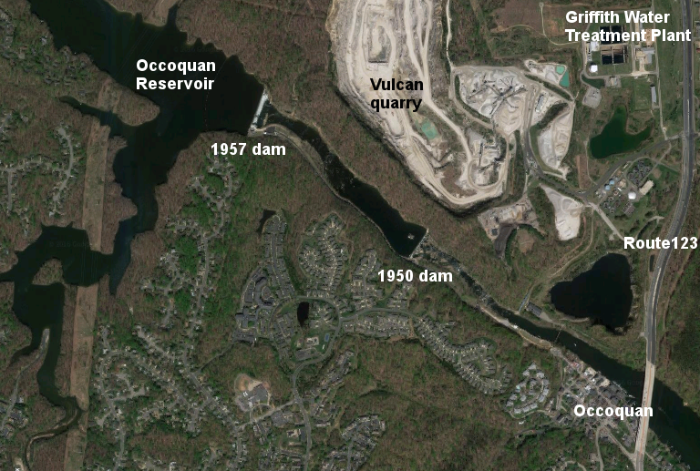
The dam reservoir (that never gets old…) is managed by the Fairfax Water Authority. It serves Fairfax County and the City of Alexandria. Here is a website about the Occoquan watershed from Virginia Department of Game and Fisheries: https://www.dgif.virginia.gov/waterbody/occoquan-reservoir/
We gave them a call. Got ahold of the gentleman in charge of the dam.
It turns out, Fairfax does not open the floodgates unless there is a hurricane on the way. This makes sense…If you predict a lot of rainfall is heading your way, it is a good idea to lower the level on the reservoir to prepare for it. So where does the torrent we see come from?
Fairfax stated that when the reservoir is full to the brim (like last year), every rainstorm overflows it. Important fact (we’ll use this later): The reservoir is 122 feet deep at the dam, right before it overflows.
Did you notice that the times of heavy current coincided with days with heavy thunderstorms? Yep. We kept track. The reservoir was full all last year (Summer of 2018). Did you notice there were very few this summer (2019)? The reservoir is down a bit, so thunderstorms do not put it over the top. It’s that simple.
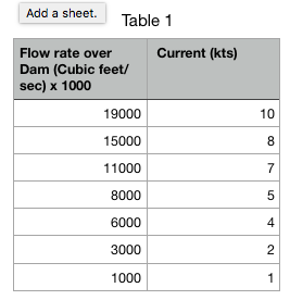
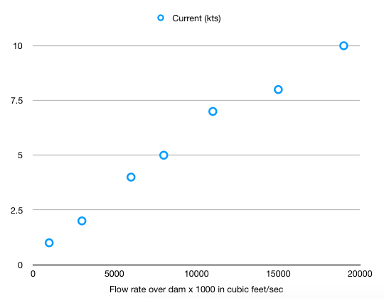
Fairfax also directed us to the Virginia Tech’s Occoquan Watershed Monitoring Laboratory. Turns out, they monitor the entire watershed with gauges and flow meters. Flow rates over the dam vary. Zero when the reservoir is not full to the brim. The highest we saw last year was 19,600 cubic feet per second. And since we enjoy this kind of thing, we plotted out flow rates vs the currents we estimated at the dock (or from boats). See Table 1.
Here is the OWML website, where you can learn about the whole study. http://www.owml.vt.edu/aboutowml/about.html
And, you can access the data for free. Once you log on, you can access gauge ST01 at the dam. Since you know that the full reservoir is 122 feet deep, you will know if the reservoir is full. If it is full, and the forecast calls for a lot of rain, you can predict that the river will be running high starting 6 hours after the rain, and tapering off 1 to 2 days after the rain.
Here is how you do it. Hit the link https://wqdata.owml.vt.edu/login.xhtml?message=&returnURL=/secure/start.xhtml
First, get a free password/login.
Once you log in, you will see this map:
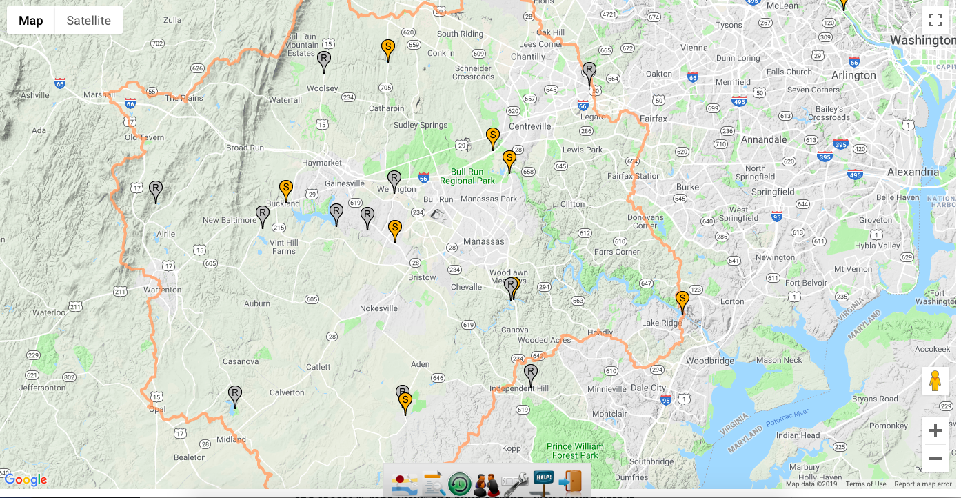
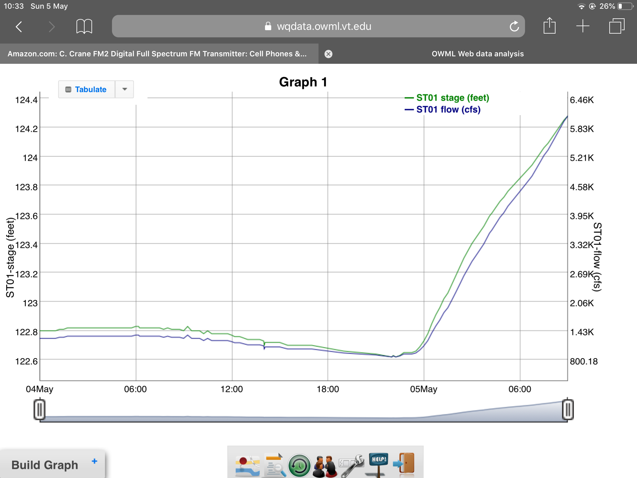
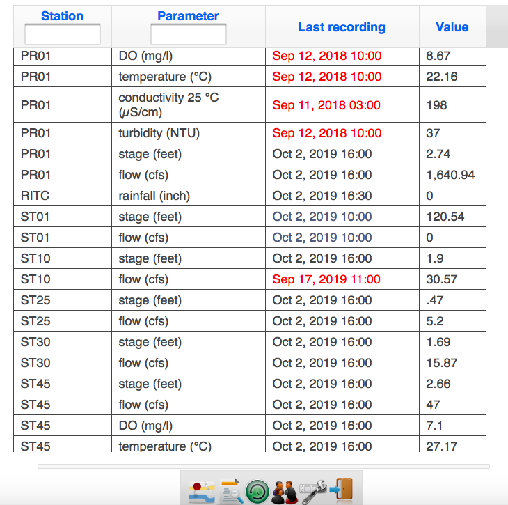
Choose the icon that says “Latest Readings” and scroll down to ST01. Stage is reservoir depth (Worry if it is over 122 feet). “Flow” is water over the dam. The chart looks like this:
If you are bold, you can try the graphing feature…Go back to the map and choose “Graph View” and build a graph. Play around with it…you’ll figure it out. Below is a graph we saved from a storm in May. It shows a depth of 122.8 feet, rising to 124.4 feet with the added rainfall. Almost 2 feet of water flowing over the dam. The flow rate of 6000 cubic feet per second gave us a current we estimated to be about 4 knots at OHM.